
Today would be the first day of the trip we didn’t wake up to the sound of rain, though it did manage to do so before we left late that morning.
My first order of business was to copy and cut a stack of business cards on which I wrote down the blog address. These, I would hand out to anyone I approached for an interview. I also spent half an hour having my picture taken for a newspaper article about a trip that was already underway.
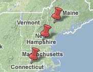
Eastern Highlands
Mansfield is full of quirky little ponds and meadows nestled in low spots within the rolling bedrock hills.

Valentine Meadow, University of Connecticut, Mansfield, CT.
The stripe you see running through the grass is an artificial drain, dug during the 19th century when the land was being converted for agriculture. Before it was a meadow, it was a wooded swamp, and before that, a marsh, pone, and glacial lake. This succession of changes is completely normal, for the fate of practically all lakes is to be filled with sediment from the surrounding landscape and from organic remains of aquatic organisms.
When the town was first settled, the swamps were preferred targets for land sales. On them, especially during winter, one could easily cut cedar for fence posts and pine for framing timber and get the logs out easily. The peat and muck were used as manure, and had bog iron for the earliest -- and always square – wrought iron nails.
Leaving town, we crossed the northeast highlands passing through the towns of Willington, Tolland, Ellington, and Somers, which are more alike than they are different. Three hundred years ago, each was a community unto itself by freedom-seeking peoples shaking off the restrictions associated with their Puritan forefathers, and moving toward the independence of the Minutemen.
We stopped at Crystal Lake, in Ellington. There, we saw gosling geese swimming in front of a massively over-developed shore. My photos were burry, which I thought was due to the rain. I figured out why the next day. I had accidentally, flipped the switch on my camera away from auto-focus to manual focus, which I had trouble doing in the heavy rain of many stops.
Quinnehtukqut
Connecticut is an anglicized version of an Algonquin word for “land beside the long tidal river.” The Connecticut River, New England’s longest, originates in southern Quebec before flowing 400 miles to its saltwater estuary in Long Island Sound. The river occupies a the Connecticut River Valley, a broad geological lowland containing layered sedimentary rocks that are much less resistant to erosion than the much harder igneous and metamorphic rocks holding up the highlands on either side.
The soft rocks were deposited within an ancient rift valley of Jurassic age, and are therefore full of dinosaur footprints. Also present are mud-cracks, lime nodules in ancient soils, and a deep barn-red stain. Collectively, these features point to internally drained monsoon lakes that rose rapidly in response to drenching rains, and fell gradually as their waters were baked away by the tropical heat. These “brownstone” rocks full of stories about freshwater, the overflowing lakes, the erosion of adjacent, mountains, and the sandstone now being carved away.
Two hundred million years later, and the highlands are still landscapes of erosion, their valleys cut by waters of time and rendered chaotic by the arrival of at least three ice sheet invasions,
For thousands of years, The Connecticut valley was occupied by a ribbon-shaped glacial lake. Now only small versions of those impoundments lie behind its many dams, most of which were built after the hurricane floods of the mid 20th century.
Berkshires
Leaving Interstate 91 just west of Holyoke, we climbed uphill on the Massachusetts Turnpike to exit for Lee-Lenox, which gave us easy access to one of the most famous blue highways in the U.S.A., Route 7. This scenic road begins at Norwalk, Connecticut on the north shore of Long Island Sound, follows the Housatonic Valley through the Litchfield Hills and the Berkshires of Massachusetts, continues through the Valley of Vermont, crosses Lake Champlain, and ends at the Quebec border on the Saint Lawrence seaway. The entire stretch is underlain by marble, a soluble rock that has dissolved and washed to the sea.
Lenox, Massachusetts is home to the Gilded Age writer Edith Wharton and, more recently, home of the Tanglewood Music Festival. Listening to a summer evening concert by the Boston Symphony Orchestra while having a picnic supper on the grass and watching the lightning bugs flicker on and off is a wonderful experience. Lennox is also near the Berkshire town of Stockbridge, a favorite haunt of 19th century writers, notably Herman Melville and Nathaniel Hawthorne, and in the 20th century, the home and studio of illustrator Norman Rockwell.
So far on this road trip, I haven't met anyone more enthusiastically happy than Tony, whom I met at the boat launch at Laurel Lake, which straddles the Lee-Lenox border. The reason for his exuberance -- so he claims -- is not drugs or booze, or a recent success, but a steady diet of fishing in retirement.

Tony the fisherman and his wife, Laurel Lake, Lee-Lenox, Massachusetts.
Fishing, he says, is the best thing about freshwater. Four days a week on average he drives to the boat launch to spend several hours to fish from the edge of a parking lot. This is a nice lake, though hardly a spectacular one, being banked right up against the road, where the intermittent traffic noise of Route 20 can be heard. I asked him why he fishes so much. His reply: “It keeps me from being bored. The relaxation. I might meet a few guys to shoot the – &$X#% -- with.” Then I asked him where he lived. He said he spent his whole life in New York City until recently, when he moved to Great Barrington where he had a buddy who ran a Bed & Breakfast. I suspect his exuberance had had nothing to do with fishing at all, but was a natural reaction of leaving urban work for the “Life of Reilly” in the country.
Tony didn’t offer a personal downside to fresh water. Instead, he pointed to a large boulder on the opposite shore called Perch Rock.

Opposite shore of Laurel Lake, Lenox-Lee, MA.
“That,” he said, “was where guy just committed suicide. He then went to his truck to find a newspaper clipping from the day before, June 27, 2009, which reported a recent drowning, though no mention of suicide. Clearly, too much water in the wrong place can be fatal.
What fascinated me most about this chance encounter was how utterly human his fishing experience was. The nice rainbow trout he showed me was a stocked fish, born in a hatchery, fed with fertilized agricultural products, protected from predators, conveyed to the site in a tanker truck, and released into the pond. After spending some time in the water, the trout was lured to take the hook by a floating green gob of "Exclusive Power Bait," manufactured by the Power Fishing Company in Spirit Lake, Iowa. This state may have the highest concentration of fishermen per unit lake. Think of it as a moldable and insoluble marshmallow that fish just happen to like.
Today's variety of Power Bait was labeled “Chartreuse,” and perhaps it may have been that color at one time. The thing that matters is that it worked.
Valley of Vermont
From Lee-Lenox, Route 7 continues north through Pittsfield, Massachusetts, where gasoline was $2.59 per gallon. In the morning, we would have passed through the shadow of Mount Graylock, which, at 3,491 feet, is the highest elevation in state. Today, in the rain, were no shadows at all.
Next in sequence were the cities of Bennington, Manchester, and Rutland, Vermont all of are located in the Valley of Vermont, between the Green Mountains to the east and the Taconic Mountains to the west. White marble seemed to be everywhere in the road cuts, especially at Pontoosuc Lake, between Pittsfield, MA and Bennington, Vermont.

Folk art moose in downtown Bennington, Vermont.
Eventually, we climbed over the headwaters of the south-flowing Housatonic River and entered the north-draining flow of the Hoosic River. This would hardly qualify as a drainage divide in the typical sense being so gentle.
Entering Brandon, Vermont, we began to enter country characterized by enormous north-south swamps more than a mile wide and up to ten miles wide. No doubt they were underlain by the clay of a vastly expanded glacial version of Lake Champlain, which prevents the water from seeping downward.
By nightfall we found ourselves at the historic Waybury Inn, located in East Middlebury, Vermont. Built in 1810 to house and feed weary travelers like us, it's now on the National Register of Historic Places. Haley, who works the front desk, says that this place is absolutely jam packed with: parents of Middlebury College students during the fall drop-off and graduation ceremonies; charter bus tours and bicycle tours during fall foliage season; and with weddings galore during the summer.
In fact, catered wedding receptions and newlyweds are so common that Room #9 has come to be known as the honeymoon suite. In it is an antique desk so old that nobody knows where it came from. In that desk is a tiny cubbyhole of a drawer. On June 27, 1987, a couple on their wedding night put a happy note in that drawer asking subsequent couples to do the same. “In time, over 200 eloquent and sometimes deeply personal messages would be left in the room…the writing is by turns passionate, philosophical, comic, and profound.” That’s a quote from the Inn’s homepage.
Haley likes the Waybury Inn because it has spirit, imbued by her co-workers who came here for a job, but ended up staying for a career. After my first bite of dinner, my happy taste buds immediately let me know that the chef has had decades of practice.
About a century ago, the same restaurant was also pleasing the taste buds of poet Robert Frost, a frequent lodger and dinner guest. He passed the Inn twice a day when traveling between Middlebury College to the west where he taught, and his summer home in Ripton, which is only a few miles to the east. Ripton is where the famous Bread Loaf Language and Writers Conferences are held each August.
Another famous person connected to the Inn was the television comedian Bob Newhart. The Inn was the outdoor set for his sitcom, which ran from 1972 to 1978. I never saw it because, by then, I had taken an oath not to watch commercial TV. However, I do recall my father laughing his way through an earlier show of the same name in the 1960s whenever he got the chance to watch.
Building Permits
Our waiter that night was Rob, who lives in the nearby town of Salisbury, just a few miles away. What he liked best about the local water was that there was so much of it available. What he liked least was the great expense of getting rid of on-site waste water. Vermont, he said, has gotten so restrictive that it’s difficult to get a home site approved. In fact, many private landowners who bought a lot to build on have been denied a permit to build, owing to concerns about water contamination by on-site sewage treatment.
Before recent water pollution regulations, the main expense in building a summer home was the cost of materials. Now, even when a building lot is approved, he said, a homeowner can easily spend between $50,000 and $100,000 just to get a well drilled and build a wastewater system that will meet local approvals.
This makes perfect sense because Vermont prides itself as one of the “greenest,” states in the nation, and is dominated by the Green Mountains. Respectively, the majority of voters want stringent regulations, and the majority of the land is in slope, some of it quite steep. There, soils that can meet percolation test requirements are uncommon and the rock is either heavily fractured, which allows pollution to seep away quickly, or water-tight, which forces wastewater to flow near the surface to a stream.
The Water Cycle
Writers, lovers, leaf-peepers, and travelers like me come and go from the Waybury Inn. So do water molecules. So, at dinner, I asked Rob where the Inn’s water came from. Sheepishly, he said he didn’t know, saying that we were the first guests ever to ask him that question. Unfortunately, his honest ignorance is all too familiar to me, someone who has taught entering first year college students for three decades. Indeed, water is often taken for granted. It shows up, it’s used, and it’s gone.
Being an experienced waiter, he asked someone else and got an answer before returning on his next trip to our table. The water comes from a small service company to the east that gathers snowmelt, rain, and groundwater from the forested mountainsides, conveys it down the valley in a hidden pipeline, and distributes the water to the Inn and village homes.
![]()
Brook in East Middlebury, Vermont running clear, even in flood.
From there it spirals down toilets, tubs, and sinks. But it doesn't disappear. Instead, it's re-gathered as wastewater and treated, before it is sent east on a gravitational journey to Lake Champlain. After spending a few years reaching the outlet of New England’s largest lake, it spills into the Saint Lawrence River before heading northeast to the Gulf of Saint Lawrence between Quebec’s Gaspe' Peninsula and Labrador.
Entry to the North Atlantic is only the beginning of an oceanic trip tens of thousands of miles long. The first leg is northward toward Iceland, as part of a broad surface current called the Gulf Stream. Eventually, this fairly fresh -- and therefore buoyant -- water is cooled by iceberg melt to the point where it becomes dense enough to sink to the bottom. There, it reverses direction and snakes its way southward the full length of the Atlantic as a bottom-hugging current. After a decade or two, that water finds itself somewhere between the Cape of Magellan at the tip of South America and the Cape of Good Hope at the tip of Africa.
From there it continues east past the Indian Ocean into the Pacific. Eventually it warms, rises, reverses direction, and heads back to the Atlantic as a surface current. Somewhere north of the Equator it will evaporate, leaving the salt behind. The vapor becomes part of moist tropical air masses that migrate northward as giant atmospheric eddies (that sometimes become hurricanes) before migrating inland to precipitate on Ripton. The timing is such that the water Robert Frost watched go down the drain in the early 1960s may have been the water that fell on us as yesterday’s rain, or the water I watched go down the drain last night.
If you ever find yourself being asked where your water comes from, you don't have to be sheepish. Just confidently say that it comes from the Blue Planet, which recycles its water continuously,


No comments:
Post a Comment